Project

Leisure Walking Systems Working Group: making place research buildable

An EPSRC-funded academic and industry initiative that produced open technical documentation, design frameworks and evaluation tools for place-based walking systems. 25+ documents across 8 research areas, published for practitioners rather than archived for academics.

Period

2024 to 2025

Status

Complete

Role

Project lead

Areas

User research · Geospatial analysis · UX design · Policy frameworks · Open access

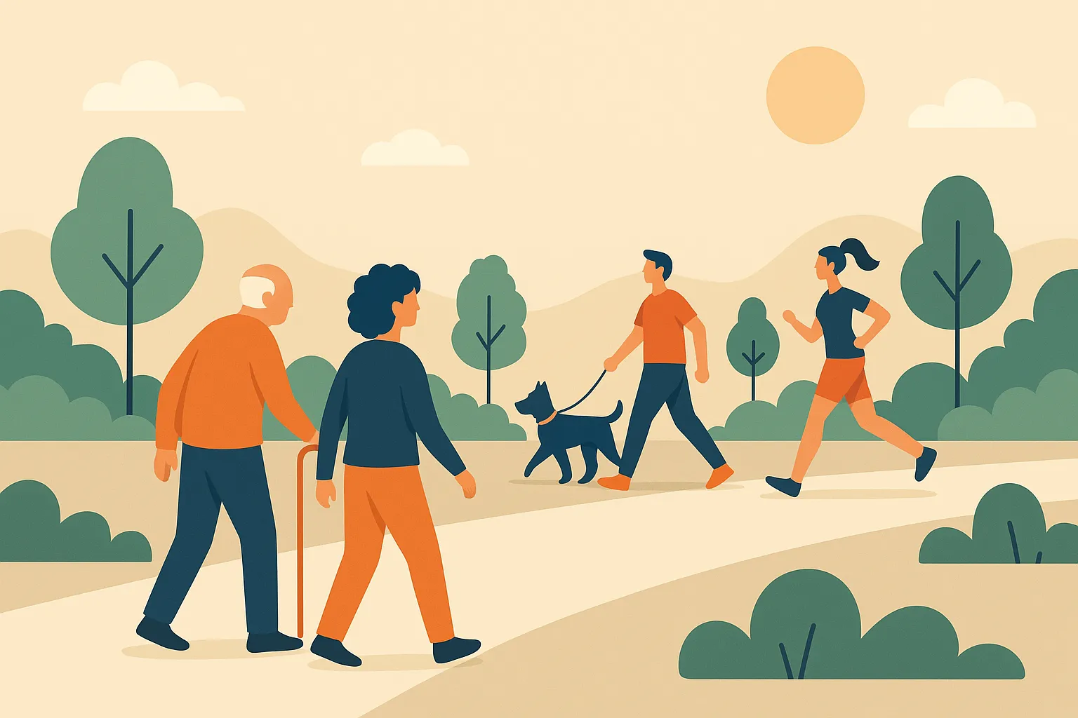
An illustration of people walking in a park: an older man with a stick, a woman beside him, a man walking a dog, and a runner.
Figure

Leisure walking is a different problem from navigation. The people in this picture are not trying to get anywhere efficiently, and no standard geospatial format describes what any of them are actually looking for.

  • 25+Technical documentsPublished openly as a practitioner knowledge base, structured for developers rather than as an academic archive.
  • 8Research areasSpanning walking system architecture, place-based design practice, and research and evaluation methods.
  • 4DeliverablesA market analysis, the knowledge platform, the Planning Checklist, and a synthesis technical report.
  • OpenAccessNo institutional gatekeeping, and built to persist beyond the three-month grant period.

The brief

Navigation apps are very good at getting somebody from A to B without wasting time. Leisure walking inverts the objective. The point is not to arrive efficiently, and the questions a recreational walker actually asks are ones no routing system can answer: is this scenic or bleak, is it safe alone after dark, does it pass anywhere worth stopping.

Those qualities are real, and they exist nowhere in standard geospatial formats. The pipelines every walking app depends on, including road networks, points of interest and terrain models, were built for logistics. Asking them about the character of a place is asking a question the schema has no field for.

The working group set out to give the field the shared reference it was missing, on the argument that the barrier to better walking applications is no longer computational. It is that everybody building one starts from scratch, invents their own vocabulary, and produces something the next team cannot build on.

The insight

The useful move was to stop treating this as a research problem and treat it as a translation problem.

There is no shortage of relevant theory. Environmental psychology has decades of work on how people respond to places. Space syntax formalises how spatial configuration shapes movement. Platial GIS has been arguing for place over coordinates for years. None of it arrives in a form a developer with a sprint deadline can use, so in practice none of it reaches the applications where it would matter.

This was not an abstract observation. WalkGrid had spent four years demonstrating both halves of the problem, first that environmental preference can be modelled and routed on, as set out in the thesis, and second that every piece of it had to be built from scratch because no shared foundation existed.

So the outputs were built backwards from the point of use. Not a paper arguing that place representation matters, but a checklist that tells you what to do in the design phase and what to test before release. Not a call for better evaluation, but an evaluation framework somebody can run. The theory is all still in there, and it is packaged as instructions rather than as argument.

Publishing it openly and outside an institutional repository was part of the same reasoning. A local authority team or a two-person startup is exactly who needs this, and exactly who will not pay for journal access or know to look.

What it does not do

It sets no standard. The representation gap is named, described and argued about, but the group did not produce a schema, and until somebody does the underlying interoperability problem remains exactly where it was.

The documentation is a synthesis of existing work and expert convening rather than new empirical research. That was the right shape for a three-month impact grant and it means the frameworks here are reasoned rather than validated. The Planning Checklist has not been through a controlled trial against teams who did not use it.

Adoption is unmeasured. The platform is public and built to persist, but the project ended before there was any evidence about who found it or whether the applications built afterwards were better for it.
How it works

5 stages
  1. 01

    Convene across the divide

    The group brought together academic researchers, walking system developers, GIS organisations and public health practitioners. These communities have overlapping goals and almost no shared vocabulary, which is a large part of why the gap it set out to close had stayed open.

    Three months, funded by the Horizon CDT Impact Grant. Short and focused suits knowledge transfer better than a long programme with a distant deliverable.

  2. 02

    Name the structural problems

    Three barriers turned out to compound each other. Data fragmentation, because environmental quality, safety, heritage and accessibility records sit with different bodies under incompatible schemas and licences. A representation gap, because formats like GeoJSON offer a flat bag of properties with no vocabulary for how a place feels. And evaluation blindspots, because apps get tested for whether the route works rather than whether the walk was good.

    Each is tractable alone. Together they mean a developer who wants to build something better has nowhere to start.

  3. 03

    Document the technical landscape

    The first domain covers the computational infrastructure of walking apps: recommendation architectures across collaborative, content-based and hybrid approaches, route algorithms and multi-criteria optimisation, walkability metrics and how they are actually operationalised, and contextual factors including weather, time of day and personal mobility.

    Written as a survey a developer can act on, not a literature review.

  4. 04

    Build a design framework for place

    Walking interfaces should not behave like navigation apps. The design strand covers accessibility-first practice, interface patterns that reduce screen time, and the deliberate design of slowness and serendipity, building in affordances for discovery rather than efficiency.

    Operationalises concepts from environmental psychology and space syntax into principles a designer can apply without a research background.

  5. 05

    Ship an implementation guide

    The flagship output is the Planning Checklist: a phase-by-phase guide through the design, development, testing and release of a context-specific walking app, alongside a framework for capturing place qualities and guidance on ethics for research with vulnerable users in urban environments.

    A developer can read the checklist, apply the patterns, adopt the evaluation framework, and produce a better walking app without reading a single paper.

Figures

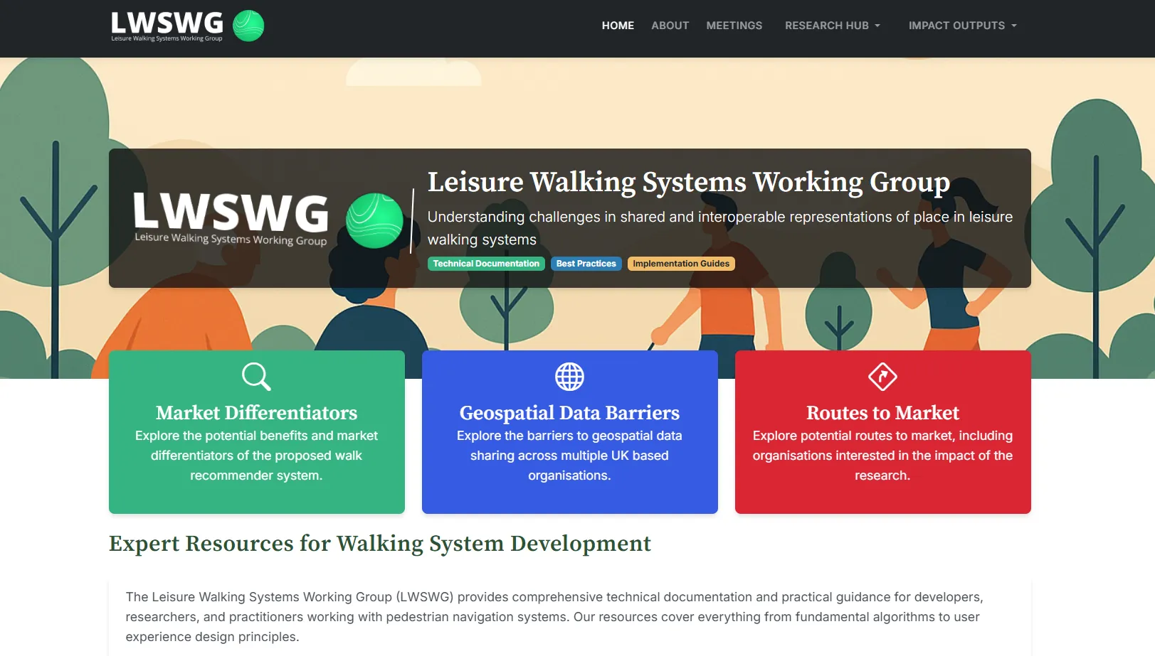
The LWSWG website homepage showing the working group's three focus areas.
Fig. 1

The knowledge platform. Three entry points covering market differentiators, geospatial data barriers and routes to market, with direct paths for developers new to walking systems and for those ready to build.

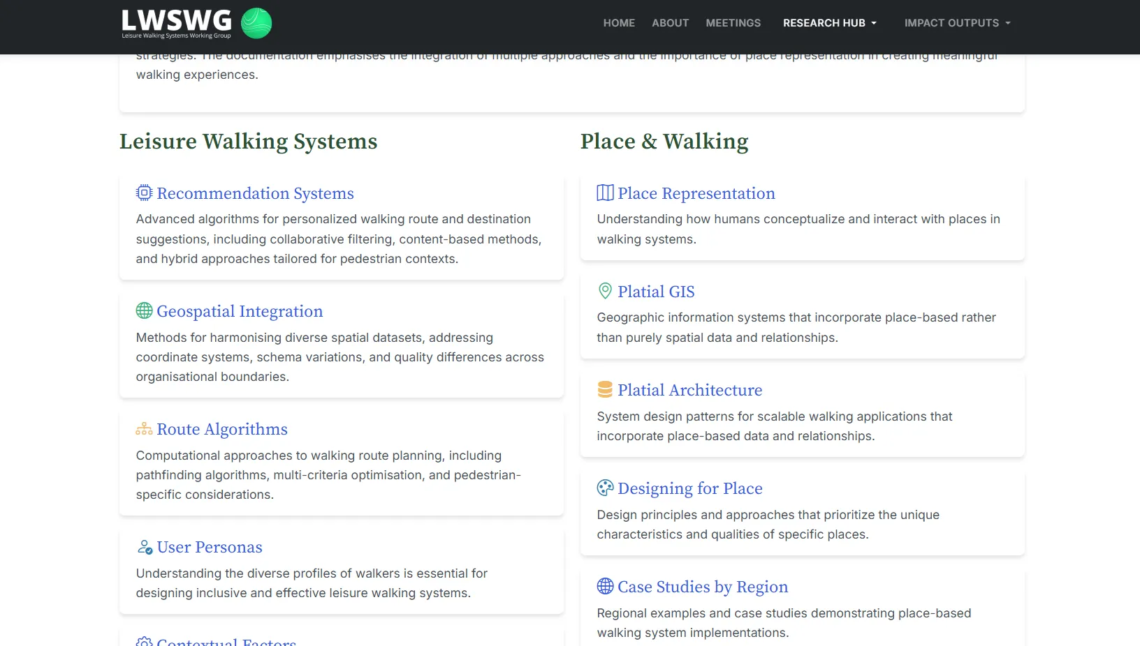
The LWSWG community research hub showing topic areas across leisure walking systems and place and walking.
Fig. 2

Two parallel knowledge tracks. One covers the technical landscape of walking systems, the other the theoretical foundations of place-based design, so a reader can enter from either the engineering or the research side.

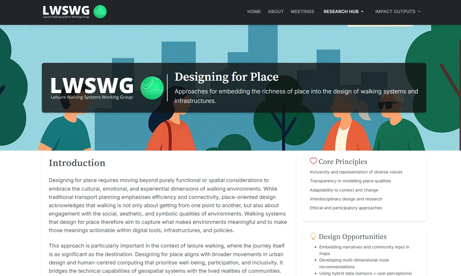
The Designing for Place framework page showing core principles and design opportunities.
Fig. 3

The Designing for Place framework. Environmental psychology and space syntax are rich sources of ideas and hard to act on, so this translates them into design principles stated as things to build.

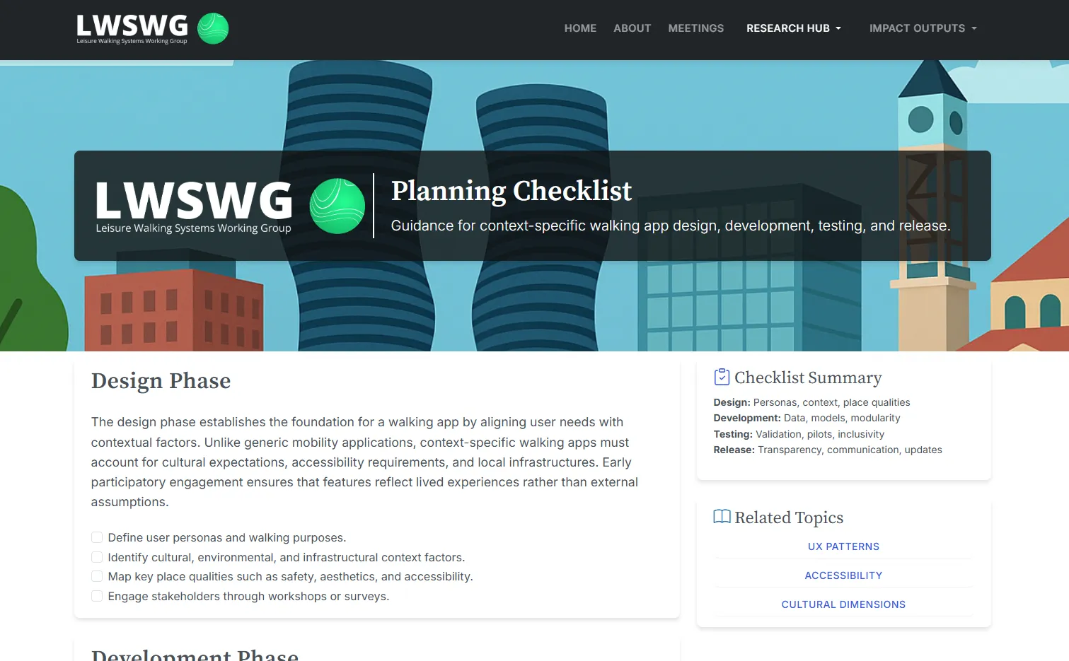
The LWSWG Planning Checklist showing design phase, development phase and checklist summary.
Fig. 4

The Planning Checklist. The output most likely to be used, because it meets a developer at the point of a decision rather than at the point of a citation.

Outcomes

  • A shared frame of reference, not another algorithm

    The contribution is deliberately not a new dataset or model. It is open documentation that bridges academic concepts such as platial GIS, environmental psychology and space syntax with practitioner needs such as APIs, schemas and evaluation protocols, so the next generation of walking applications can be built on better foundations.

  • Published for the people who build things

    Everything sits at lwswg.jwilliams.science as a practitioner-facing knowledge base with no institutional gatekeeping. Any developer, researcher or local authority working on pedestrian systems can use it directly, and it was built to outlast the grant that funded it.

  • Evaluation methods written down in one place

    Most walking apps are tested for technical correctness rather than experiential quality. The group produced a comparative evaluation framework, methodology guidance, and a structured approach to capturing place qualities across both subjective and objective measures.

  • A model for short-form knowledge transfer

    Three months, industry-oriented, with outputs designed to be immediately usable. The impact grant format proved well suited to closing a gap that neither a research programme nor a commercial roadmap was going to close on its own.

Stack

Research methods
User research, Comparative evaluation, Ethics frameworks, Stakeholder convening
Domains
Platial GIS, Environmental psychology, Space syntax, Walkability metrics
Systems covered
Recommender architectures, Multi-criteria routing, Pedestrian constraints, Contextual modelling
Design practice
Accessibility-first design, Low-screen-time patterns, Designing for serendipity, Visual cue systems
Outputs
Knowledge platform, Planning Checklist, Market analysis, Technical report

Partners

  • Engineering and Physical Sciences Research Council
  • Horizon Centre for Doctoral Training
  • Ordnance Survey
  • University of Nottingham

This activity was supported by the Horizon CDT Impact Grant, made possible through funding from the Engineering and Physical Sciences Research Council (EPSRC) [grant number EP/S023305/1].

Work like this

Start a
conversation →

Available for consulting engagements and research collaborations at this scale. Email james@jameswil.com.